
Hike Report for Sabattus Mountain
Sabattus Mountain is located in Maine, United States. It has an elevation of 382 meters above sea level. It is located at the following coordinates: (44.1824, -70.8513).
This hike report was written by Douglas Twitchell, about a hike on Saturday, August 10, 2013.
This report describes a hike on Summit Loop Trail
This report describes a hike on Summit Loop Trail
Not enough votes to display a rating
Directions to Summit Loop Trail
Traveling south on Route 5 into Lovell, the Sabattus Mountain Road is on the left. This is easily recognized, because there is a sign for the hiking trail on the right, pointing toward the road.
Travel down the Sabattus Mountain Road until you get to a right hand turn that is a dirt road named Sabattus Trail Road. Follow this road until you get to the trail parking area, which is on the right, and labeled.
Travel down the Sabattus Mountain Road until you get to a right hand turn that is a dirt road named Sabattus Trail Road. Follow this road until you get to the trail parking area, which is on the right, and labeled.
Hike Report
Starting out at the parking lot, you don't travel very far before you reach a fork in the trail. Go left, or go straight ahead - either way you'll get to the summit. I don't really think there's much difference between the two - the trails were very similar, and we could have done the loop in either direction without any problem. Laura voted for clockwise, so we turned left.
The trail was muddy in places (not surprising, considering we'd had over two inches of rain the day or two prior to hiking!)
It was not overly steep, but just steep enough to get our hearts pumping, since we tend to hike at a pretty good pace.
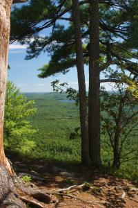
The summit consists of a couple ledges with views toward the south and east, and a little toward the west.
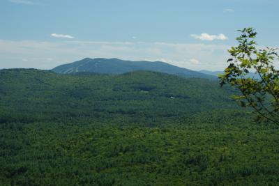
View of Pleasant Mountain
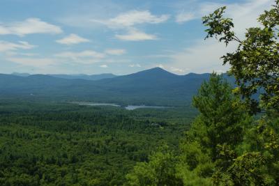
View of Kearsarge North and Chocorua
I did read in one hike report that although the hike is easily doable by children, care should be taken since there are open ledges with steep drop-offs. This is true.
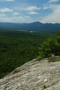
View of Kerasarge North and the ledge
There are a couple benches at the summit, so you can sit and enjoy the view.
The hike down was uneventful, other than trying to dodge a couple muddy spots on the trail!
The trail was muddy in places (not surprising, considering we'd had over two inches of rain the day or two prior to hiking!)
It was not overly steep, but just steep enough to get our hearts pumping, since we tend to hike at a pretty good pace.
The summit consists of a couple ledges with views toward the south and east, and a little toward the west.
View of Pleasant Mountain
View of Kearsarge North and Chocorua
I did read in one hike report that although the hike is easily doable by children, care should be taken since there are open ledges with steep drop-offs. This is true.
View of Kerasarge North and the ledge
There are a couple benches at the summit, so you can sit and enjoy the view.
The hike down was uneventful, other than trying to dodge a couple muddy spots on the trail!
Difficulty
Easy hike, good for families.
Statistics
The hike is about 1.5 miles round trip, and probably took us about an hour.
Images
Images on this page are the property of Douglas Twitchell, and may not be used without permission of the owner.

