
Hike Report for White Cap Mountain
White Cap Mountain is located in Maine, United States. It has an elevation of 1111 meters above sea level. It is located at the following coordinates: (45.5545, -69.246).
This hike report was written by Douglas Twitchell, about a hike on Saturday, September 12, 2009.
This report describes a hike on Appalachian Trail
This report describes a hike on Appalachian Trail
Not enough votes to display a rating
Hike Report
Hiking White Cap was supposed to be a brief interruption in a trip from Southern Maine to Fort Kent. It's not a huge mountain, so it shouldn't take much time, right?
Okay, somehow I missed the fact that the roads in Katahdin Iron Works are a maze of logging roads that have potholes as deep as my car. I spent more time driving (and scraping the bottom of my car) than I spent hiking the mountain.
Though I did get some nice scenery along the way...
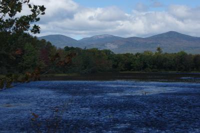
View from the "road"
Nevertheless: Do not drive into KIW unless you have a high-posted vehicle!
It turned out I couldn't even get to the mountain; I had to park a long ways away and walk in to the mountain. Here's where I got out of my car, and that's White Cap in front of me:
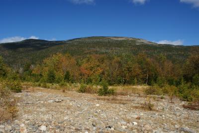
White Cap
The trail is actually the Appalachian Trail, and it's well marked. White Cap is known among Appalachian Trail hikers as the spot where you get your first unobstructed view of Mount Katahdin.
There is a place partway up the mountain where you have an option to take a right-hand turn onto another trail that goes more directly to the summit. Since I was running behind schedule, I decided to take this short cut. It's definitely shorter, but the trade-off is that it's very steep compared to the longer trail.
The views at the top are nice, but honestly, even though seeing Katahdin is the exciting thing for Appalachian Trail hikers, I thought some of the views in other directions were just as nice. Since I always see the Bigelow Range from the southern side, it was surprising to me to see this range mirror-image, with the tallest peaks on the left, and the shorter ones on the right.
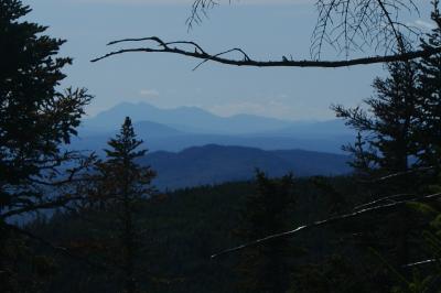
Bigelow Range
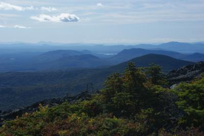
More views
And here's Katahdin:
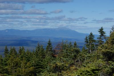
View of Katahdin
Okay, somehow I missed the fact that the roads in Katahdin Iron Works are a maze of logging roads that have potholes as deep as my car. I spent more time driving (and scraping the bottom of my car) than I spent hiking the mountain.
Though I did get some nice scenery along the way...
View from the "road"
Nevertheless: Do not drive into KIW unless you have a high-posted vehicle!
It turned out I couldn't even get to the mountain; I had to park a long ways away and walk in to the mountain. Here's where I got out of my car, and that's White Cap in front of me:
White Cap
The trail is actually the Appalachian Trail, and it's well marked. White Cap is known among Appalachian Trail hikers as the spot where you get your first unobstructed view of Mount Katahdin.
There is a place partway up the mountain where you have an option to take a right-hand turn onto another trail that goes more directly to the summit. Since I was running behind schedule, I decided to take this short cut. It's definitely shorter, but the trade-off is that it's very steep compared to the longer trail.
The views at the top are nice, but honestly, even though seeing Katahdin is the exciting thing for Appalachian Trail hikers, I thought some of the views in other directions were just as nice. Since I always see the Bigelow Range from the southern side, it was surprising to me to see this range mirror-image, with the tallest peaks on the left, and the shorter ones on the right.
Bigelow Range
More views
And here's Katahdin:
View of Katahdin
Images
Images on this page are the property of Douglas Twitchell, and may not be used without permission of the owner.

