
Hike Report for Old Speck Mountain
Old Speck Mountain is located in Maine, United States. It has an elevation of 1268 meters above sea level. It is located at the following coordinates: (44.5709, -70.9537).
This hike report was written by Douglas Twitchell, about a hike on Tuesday, September 23, 2008.
This report describes a hike on Firewarden Trail
This report describes a hike on Firewarden Trail
Not enough votes to display a rating
Directions to Firewarden Trail
Drive up Route 26 through Bethel and Newry. You will see a large sign announcing that you are entering the Grafton Notch area. You will pass Screw Auger Falls, and then a little ways down the road on the right (very clearly marked with a large sign) you will see the parking lot for the hiking trails for both Old Speck and Baldpate.
Hike Report
The first time I hiked Old Speck, it was raining. And the observation tower was falling apart and closed. It was a miserable day, and I said, "Never again."
But a few days ago Bobby said he would like to do it, so I said I'd go with him. The experience this time around was MUCH nicer.
We started out around 9:15 in the morning, and discussed whether we should go straight for the summit, and do the Eyebrow on the way back, or hit the Eyebrow first.
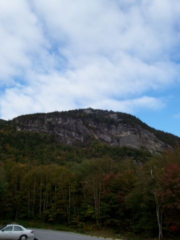
The Eyebrow, viewed from the parking lot
Since the Eyebrow is the steepest part of the trail, and we both prefer going UP over steep parts to going DOWN over them, we decided to do the Eyebrow on the way up.
I think that was a good choice. You won't even be hiking for ten minutes before you hit the branch where you choose the AT, or the Eyebrow trail. Turn right to do the Eyebrow, continue straight to follow the AT.
The Eyebrow trail is marked with red blazes, and it is a fairly steep climb. But it isn't really all that difficult, because there are handholds, and rungs, and ladders, and even a series of posts with a cable strung between them as a hand rail. Even with all the helps, be prepared to give your legs and lungs and heart a workout.
At one point as you climb, you'll cross over a boulder with hand-rungs and a ladder, and then a little bit later on you'll do almost a complete U-Turn. Now you're getting close to the cliff. Watch for places where people have steered off the trail to the left; there are a couple places where you can push branches aside to get some interesting views of Grafton Notch, and the parking lot far below.
The Eyebrow is the best spot to get a nice view of Route 26 winding through the notch; it's about like Tablerock on the other side of the road, but it's a bit higher up.
Once you pass the Eyebrow, you will return to the Appalachian Trail. At this point it is important that you have the geography of this hike firmly in mind. Because turning LEFT onto the AT feels like a good choice, since it is heading in the right direction for the summit. However, LEFT is downhill. RIGHT, which feels like it is going in exactly the wrong direction, is the trail you should take. Remember: this ridiculous trail loops all the way around the ridge to get to the summit, so most of the time you are facing the wrong way!
After doing the Eyebrow, the next section of the AT seemed quite pleasant and easy. Not very steep, just a stroll through the woods. From here until the summit, you'll alternate between stretches of very shallow incline and short bursts of much steeper incline. It makes for a long hike, but it's not as relentlessly steep as some.
You need to be on the lookout all around you as you get close to the summit; there are some places where it's nice to pause and take a look at the views. Sometimes those views are partly hidden by tree branches, but still, it's worth pausing to look.
Eventually you will reach a fork where you can choose to continue on the AT, toward Speck Pond, or you can branch toward the summit.
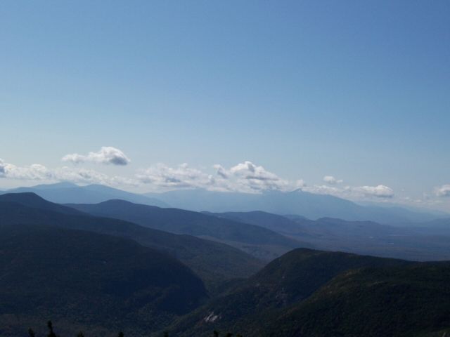
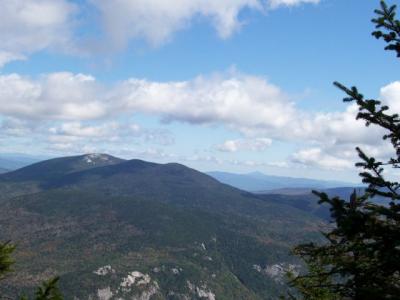
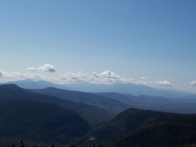
And here's the wonderful news: the new observation tower at the summit is open! Climb up the ladder to the railed platform at the top and you can see 360 degree views! Absolutely beautiful! From here you can see Mount Washington (if the clouds aren't obscuring it). You can also see (obviously) Baldpate, which is the closest mountain to you. Also, to the right of Baldpate you may see a cone-shaped mountain sticking out above the others. This is Mount Blue.

Baldpates
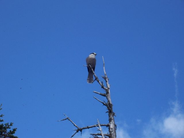
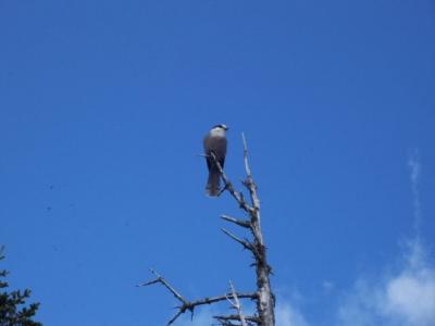
Bobby and I snapped some pictures, and then came down from the tower to eat lunch. At this point, the birds swarmed in; apparently enough people toss scraps to the birds that they have ceased being afraid of humans. One of them stood on Bobby's hand and pecked away at a bit of sandwich Bobby was holding for him.
After all that fun, we headed back down to the base. It was only 2.5 hours back down, but it seemed to be a very long time, and we were glad to see the parking lot again.
I put my $2.00 in the fee slot, and said, "That observation tower is worth the fee, for sure!"
But a few days ago Bobby said he would like to do it, so I said I'd go with him. The experience this time around was MUCH nicer.
We started out around 9:15 in the morning, and discussed whether we should go straight for the summit, and do the Eyebrow on the way back, or hit the Eyebrow first.
The Eyebrow, viewed from the parking lot
Since the Eyebrow is the steepest part of the trail, and we both prefer going UP over steep parts to going DOWN over them, we decided to do the Eyebrow on the way up.
I think that was a good choice. You won't even be hiking for ten minutes before you hit the branch where you choose the AT, or the Eyebrow trail. Turn right to do the Eyebrow, continue straight to follow the AT.
The Eyebrow trail is marked with red blazes, and it is a fairly steep climb. But it isn't really all that difficult, because there are handholds, and rungs, and ladders, and even a series of posts with a cable strung between them as a hand rail. Even with all the helps, be prepared to give your legs and lungs and heart a workout.
At one point as you climb, you'll cross over a boulder with hand-rungs and a ladder, and then a little bit later on you'll do almost a complete U-Turn. Now you're getting close to the cliff. Watch for places where people have steered off the trail to the left; there are a couple places where you can push branches aside to get some interesting views of Grafton Notch, and the parking lot far below.
The Eyebrow is the best spot to get a nice view of Route 26 winding through the notch; it's about like Tablerock on the other side of the road, but it's a bit higher up.
Once you pass the Eyebrow, you will return to the Appalachian Trail. At this point it is important that you have the geography of this hike firmly in mind. Because turning LEFT onto the AT feels like a good choice, since it is heading in the right direction for the summit. However, LEFT is downhill. RIGHT, which feels like it is going in exactly the wrong direction, is the trail you should take. Remember: this ridiculous trail loops all the way around the ridge to get to the summit, so most of the time you are facing the wrong way!
After doing the Eyebrow, the next section of the AT seemed quite pleasant and easy. Not very steep, just a stroll through the woods. From here until the summit, you'll alternate between stretches of very shallow incline and short bursts of much steeper incline. It makes for a long hike, but it's not as relentlessly steep as some.
You need to be on the lookout all around you as you get close to the summit; there are some places where it's nice to pause and take a look at the views. Sometimes those views are partly hidden by tree branches, but still, it's worth pausing to look.
Eventually you will reach a fork where you can choose to continue on the AT, toward Speck Pond, or you can branch toward the summit.
And here's the wonderful news: the new observation tower at the summit is open! Climb up the ladder to the railed platform at the top and you can see 360 degree views! Absolutely beautiful! From here you can see Mount Washington (if the clouds aren't obscuring it). You can also see (obviously) Baldpate, which is the closest mountain to you. Also, to the right of Baldpate you may see a cone-shaped mountain sticking out above the others. This is Mount Blue.
Baldpates
Bobby and I snapped some pictures, and then came down from the tower to eat lunch. At this point, the birds swarmed in; apparently enough people toss scraps to the birds that they have ceased being afraid of humans. One of them stood on Bobby's hand and pecked away at a bit of sandwich Bobby was holding for him.
After all that fun, we headed back down to the base. It was only 2.5 hours back down, but it seemed to be a very long time, and we were glad to see the parking lot again.
I put my $2.00 in the fee slot, and said, "That observation tower is worth the fee, for sure!"
Difficulty
The hike is deceptively long. As you stand in the parking lot, it doesn't look like it's a long way to the summit. But you actually head way off in the wrong direction, and then loop around on a ridge. Because if this, the trail is not as steep as the old trails which are apparently now closed. However, it is still a good workout.
The steepest part of the hike is the Eyebrow, an optional side trail which puts you at the top of a cliff overlooking Grafton Notch. Even this, though it is difficult, is not unreasonably so; there are handrails and rungs and ladders to help you over the hardest parts.
The steepest part of the hike is the Eyebrow, an optional side trail which puts you at the top of a cliff overlooking Grafton Notch. Even this, though it is difficult, is not unreasonably so; there are handrails and rungs and ladders to help you over the hardest parts.
Statistics
Round trip, this hike is about 8 miles. It's just a little bit longer (maybe a couple tenths of a mile) if you take the side trail to the Eyebrow. Including the Eyebrow, it took us about 3.5 hours to get up, and another 2.5 to get back down. Our elevation gain was 2680 to the summit, and it was 1100 to the Eyebrow.
Images

Images on this page are the property of Douglas Twitchell, and may not be used without permission of the owner.

